Chapter 9
Map settings
How the map looks and behaves: where your position comes from, units, light or dark, and how to have maps ready for places with no signal.
9.1Map settings
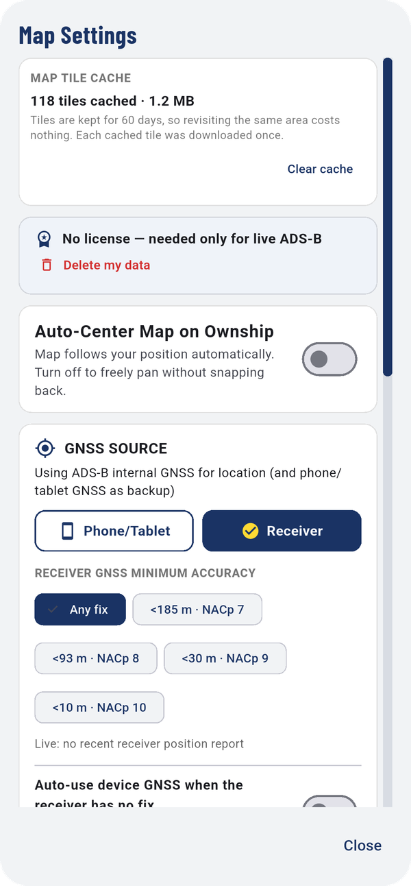
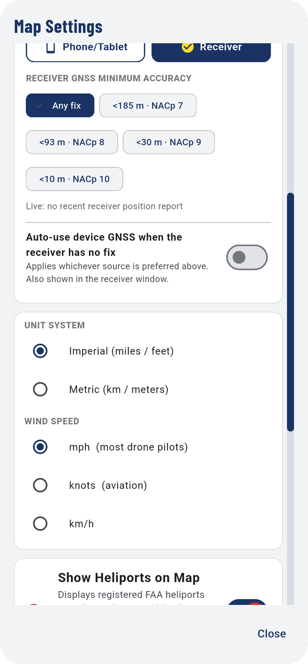
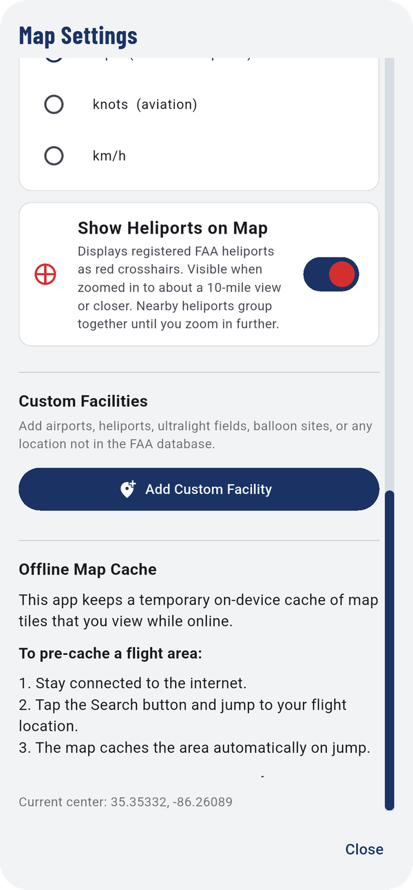
- MAP TILE CACHE: how much map is stored on the phone. Clear cache frees the space. Tiles are kept for 60 days.
- Your license, and Delete my data.
- Auto-Center Map on Ownship: the map follows you. Turn it off to pan freely without snapping back.
- GNSS SOURCE (Where your position comes from).
- UNIT SYSTEM and WIND SPEED (Units).
- Show Heliports on Map: FAA heliports as red crosshairs, visible when zoomed in to about a 10-mile view or closer.
- Custom Facilities: Add Custom Facility for an airport, heliport, ultralight field, balloon site or any place missing from the FAA database.
- Offline Map Cache (Maps with no signal).
9.2Where your position comes from
GNSS SOURCE chooses whose GPS sets your position: Phone/Tablet or Receiver. With Receiver selected, the phone's GPS is the backup.
- RECEIVER GNSS MINIMUM ACCURACY: ignore receiver positions less accurate than this. Any fix accepts everything.
- Auto-use device GNSS when the receiver has no fix: switch to the phone's GPS automatically while the receiver has no position.
The GNSS: line in the status bar shows which is in use.
9.3Units
- UNIT SYSTEM: Imperial (miles / feet) or Metric (km / meters).
- WIND SPEED: mph (most drone pilots), knots (aviation) or km/h.
9.4Light or dark map
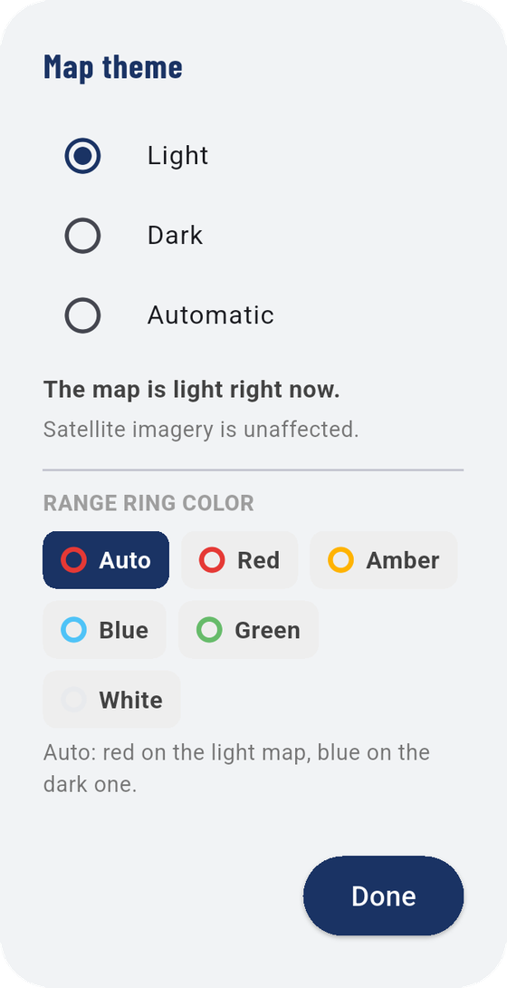
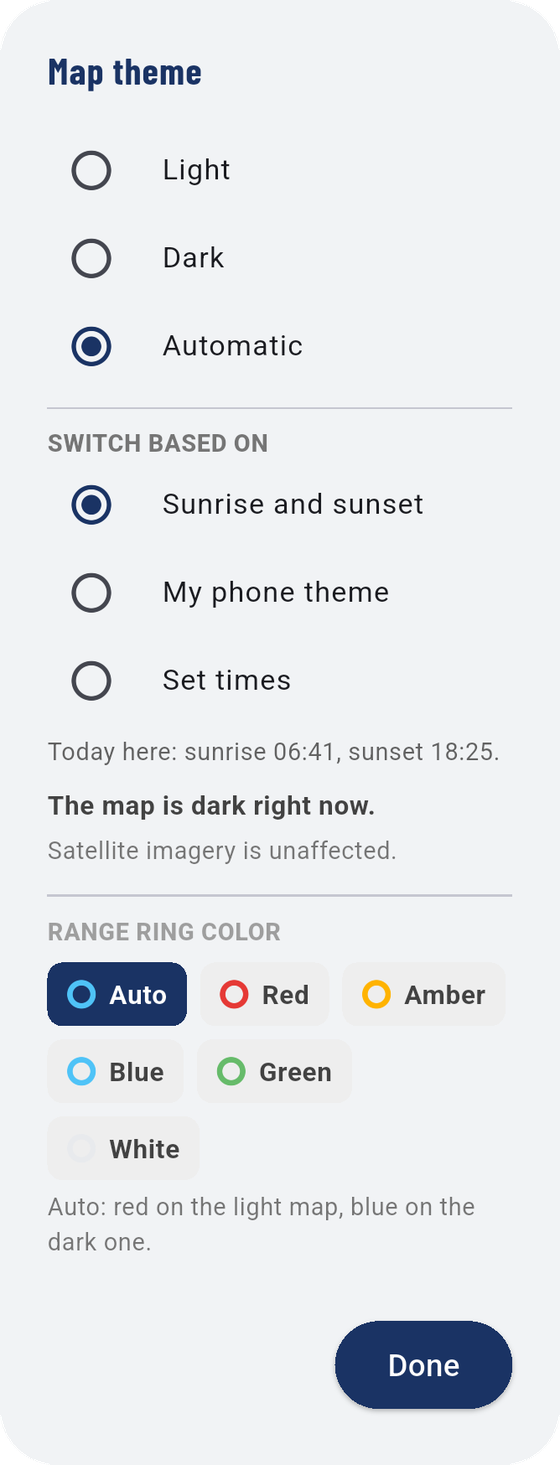
- Light, Dark, or Automatic.
- With Automatic, choose what it follows: Sunrise and sunset (today's times are shown), My phone theme, or Set times.
- RANGE RING COLOR: Auto (red on the light map, blue on the dark one), or a fixed Red, Amber, Blue, Green or White.
Satellite imagery isn't affected. Tap Done.
9.5Maps with no signal
The app keeps the map you've looked at while online, so it's there when you lose signal in the field. To get an area ready before you go:
- Stay connected to the internet.
- Tap
 Search and jump to your flight location.
 - The app caches the area as it jumps.
Cached map tiles are kept for 60 days. Do this before you use Direct connect, which takes your phone off the internet.
9.6Jump to a location
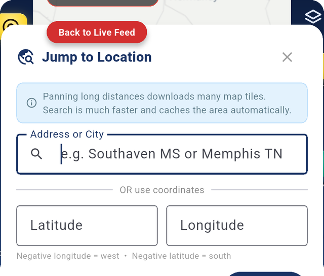
Type an Address or City, or a Latitude and Longitude (negative longitude is west, negative latitude is south), and tap Jump. Zoom to Home Location brings you back. Searching is much faster than panning a long way, and it caches the area as it goes.