Chapter 6
Your focus area and your drones
By default everything is measured from you: the range rings, the rules, the spoken distances. Often what matters is somewhere else: the field you're spraying, the tower you're inspecting, or your drone itself. The POI (point of interest) button moves the center of attention there.
6.1Choose your focus area
Select Focus Area opens on the POI tab.
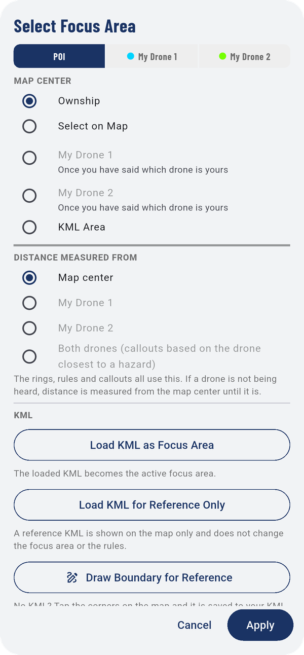
MAP CENTER decides where the map is centered:
- Ownship: you, the usual choice.
- Select on Map: a spot you pick on the map, such as a job site.
- My Drone 1 / My Drone 2: follow one of your drones. These become available once you've told the app which drone is yours (Your drones: My Drone 1 and My Drone 2).
- KML Area: an area you loaded from a KML file.
DISTANCE MEASURED FROM decides where distances are measured from: Map center, My Drone 1, My Drone 2, or Both drones (callouts based on the drone closest to a hazard). The rings, rules and callouts all use it. If a drone isn't being heard, distance falls back to the map center until it is.
Under KML:
- Load KML as Focus Area: the loaded area becomes the active focus area.
- Load KML for Reference Only: shows the area on the map without changing the focus or the rules.
- Draw Boundary for Reference: no KML file? Tap the corners on the map and the app saves it with your KML areas as a reference area.
Tap Apply.
6.2Your drones: My Drone 1 and My Drone 2
Needs a Remote ID receiver
With a Remote ID receiver, the app can tell your own drones from everyone else's. Your drones are drawn in cyan (My Drone 1) and lime (My Drone 2) with a thin edge; other drones carry their rule color.
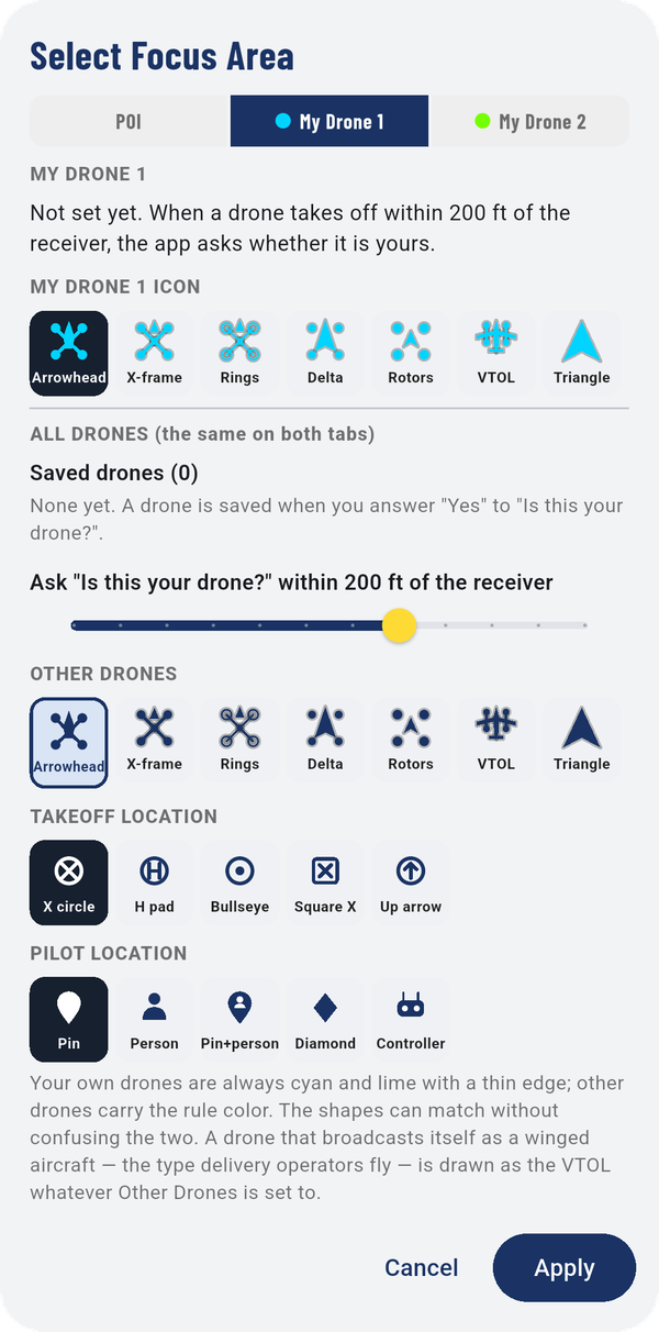
When a drone takes off within the set distance of the receiver, the app asks "Is this your drone?". Answer yes and it's saved as yours. Until then the tab reads "Not set yet."
On each tab:
- MY DRONE 1 ICON (or 2): the shape for that drone: Arrowhead, X-frame, Rings, Delta, Rotors, VTOL or Triangle.
Under ALL DRONES (the same on both tabs):
- Saved drones: drones you've said are yours.
- Ask "Is this your drone?" within N ft of the receiver: how close a takeoff has to be before the app asks.
- OTHER DRONES: the shape for everyone else's drones.
- TAKEOFF LOCATION and PILOT LOCATION: the markers for where a drone took off and where its pilot is, when the drone broadcasts them.
A drone that broadcasts itself as a winged aircraft, the type delivery operators fly, is drawn as the VTOL shape whatever Other Drones is set to.