Chapter 8
Weather and lightning
The app shows NOAA radar and satellite lightning on the map and warns you, by voice and on screen, when rain or lightning gets close. It also warns when the wind forecast at drone altitudes passes your limit.
Radar and lightning use United States data (Features that work only in the United States).
8.1Weather radar
United States onlyNeeds internet
Tap Weather to put NOAA radar over the map. Long-press it for Radar / Rain Alerts, where every weather warning is set up.

- Show NOAA Radar Overlay turns the radar on.
- Radar Opacity sets how strongly it's drawn. Lower lets the map show through.
The chip at the top left of the map shows the radar's state, for example Radar Live or Radar 1m ago. When there's lightning, it also shows the nearest flash and how long ago it was.

The bottom of the window has Silence (Silence weather alerts), Close, and Apply, which saves your changes.
8.2Lightning
United States onlyNeeds internet
Lightning comes from NOAA's weather satellites. A flash is usually located to within about 2–3 miles, and this is not a safety guarantee.
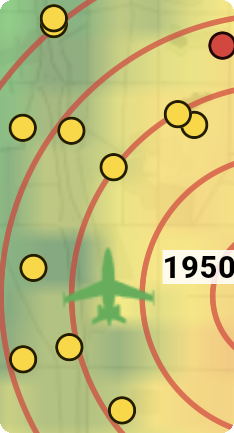
| Dot | Meaning |
|---|---|
| Red | A flash in the last 5 minutes |
| Yellow | An older flash. It disappears 30 minutes after the flash. |
In Radar / Rain Alerts:
- Show Lightning: flashes from the last 30 minutes on the map.
- Lightning range (show and warn within): how far out to show flashes and warn about them. Use − and +.
- Enable Lightning Warnings: warns on recent flashes (the last 5 minutes). All clear comes 30 minutes after the last flash inside your closest distance.
Warning distances
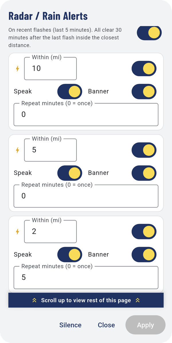
There are three warning distances, set by default to 10, 5 and 2 miles. The closest is for lightning overhead or very close. Each has:
- its own on/off switch,
- Speak: say the warning out loud,
- Banner: show it across the top of the map,
- Repeat minutes (0 = once): how often to warn again while flashes keep coming inside that distance.
A lightning warning appears as a red banner across the top of the map, with the distance and clock direction of the flash and a button to silence weather alerts.
Warning
Lightning can strike miles from a storm. When you get a lightning warning, bring your drone down and take shelter.
8.3Rain warnings
United States onlyNeeds internet
Further down Radar / Rain Alerts:
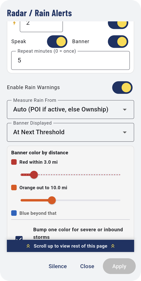
- Enable Rain Warnings turns them on.
- Measure Rain From: Auto (POI if active, else Ownship), or always from you, or always from your point of interest.
- Banner Displayed: Only Once, At Next Threshold (each time rain crosses a closer distance), or every callout.
- Banner color by distance: red within one distance, orange out to a second, blue beyond that. Bump one color for severe or inbound storms moves a storm with hail or rotation, or one heading toward you, up one color. A storm moving away is never bumped.
- Minimum Rain Area: ignore rain smaller than this, so a stray drop or two doesn't set off a warning. 0 warns on any rain.
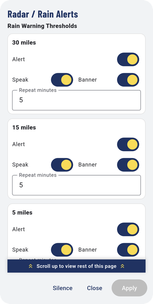
- Rain Warning Thresholds: four distances (30, 15, 5 and 2 miles), each with Alert, Speak, Banner and Repeat minutes.
The bottom of the window shows the current Radar Status, for example "Rain detected within 0.2 mi at 5 o'clock".
8.4Storm arrows
United States only
When radar shows a storm cell, the map marks it with an arrow pointing the way it's moving.
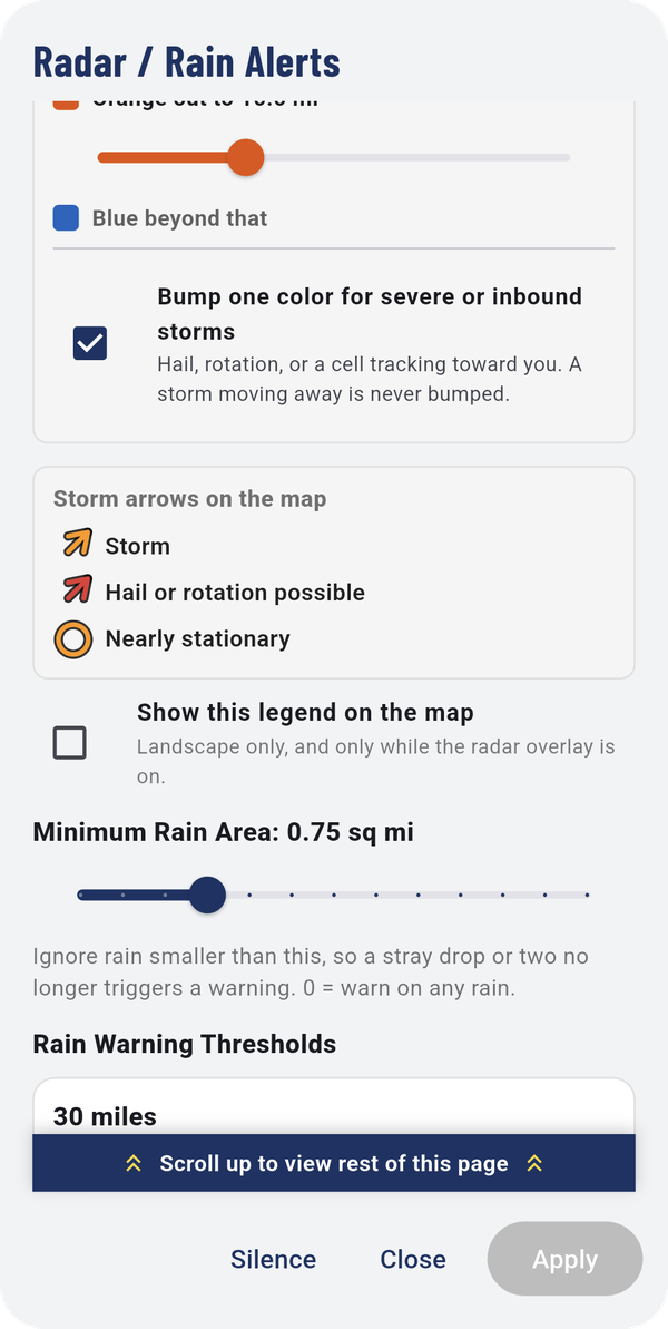
| Marker | Meaning |
|---|---|
| Orange arrow | Storm |
| Red arrow | Hail or rotation possible |
| Orange ring | Nearly stationary |
Show this legend on the map puts this key on the map. It shows in landscape only, and only while the radar is on.
8.5Silence weather alerts
Silence Weather Alerts quiets rain and lightning warnings for 5 min, 10 min or 30 min. Un-silence turns them back on.
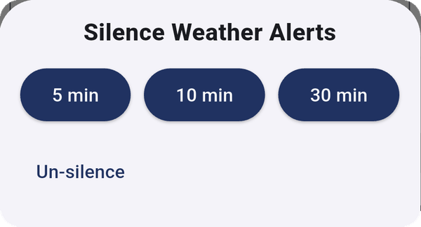
Silencing weather doesn't silence traffic. See Silence all traffic for that.
8.6Wind alerts
The app checks the winds-aloft forecast for drone altitudes and warns you when it reaches your limit. It's a forecast, not a live measurement.
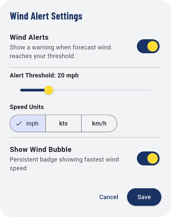
- Wind Alerts: show a warning when the forecast wind reaches your threshold.
- Alert Threshold: the wind speed that triggers the warning.
- Speed Units: mph, kts or km/h.
- Show Wind Bubble: a badge on the map with the fastest forecast wind (for example 394 ft 7 mph).